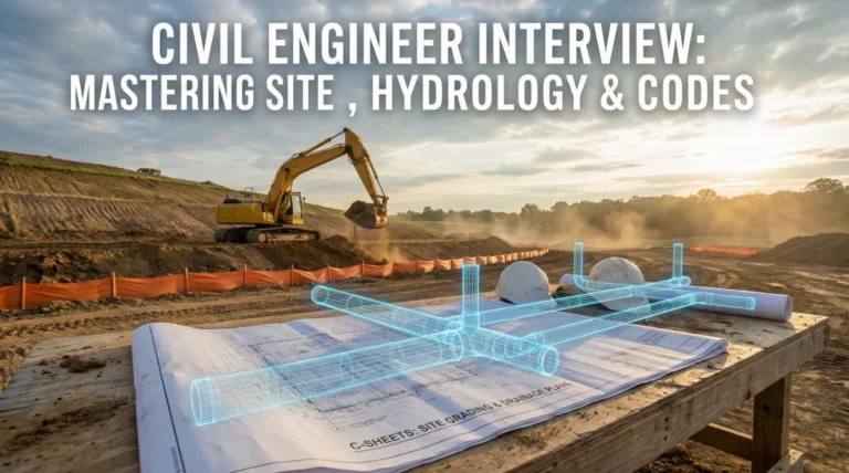
Before the First Stake
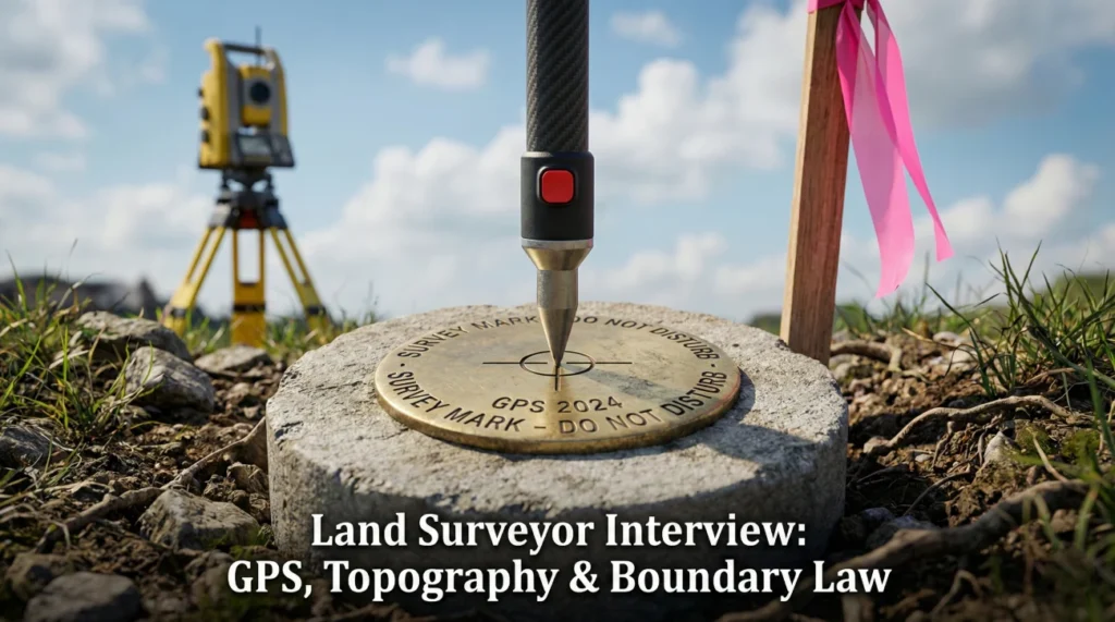
Land surveyor interview questions are built to find out if you can be accurate in the real world, not just in perfect conditions. You might be working in tall grass, near traffic, or on a site where the “corner” is buried under decades of stories and assumptions.
Hiring managers look for someone who can collect clean data, document decisions, and explain boundary logic without drama. They want to hear how you set control, check your setup, and handle conflicting evidence without creating a legal mess.
This guide leans into the practical side of geomatics: instruments, coordinate systems, and field judgment. Use it to show you can measure carefully, process data responsibly, and communicate results that contractors, owners, and inspectors can rely on.
Geodesy & Coordinate Systems
Q: Explain the difference between the Geoid, the Ellipsoid, and Orthometric Height.
This is the most critical concept for modern GPS surveying. The Ellipsoid is a smooth, mathematical model of the earth (like the WGS84 or GRS80) used by GPS satellites to calculate height ($$h$$). However, the earth is not smooth; gravity varies due to density. The Geoid is the equipotential surface that represents “Mean Sea Level” – where water would settle if stopped by nothing but gravity.
Orthometric Height ($$H$$) is what we traditionally call “elevation” above sea level. The relationship is $$H = h – N$$, where $$N$$ is the Geoid Height (separation). GPS natively measures Ellipsoid height. To get a useful elevation for construction (water flow), we must apply a Geoid Model (like GEOID18). Failing to apply the correct geoid model can result in elevation errors of 30 meters or more, which is catastrophic for drainage design.
Q: Describe the “Hierarchy of Evidence” in boundary surveying.
When retracing a property line, evidence often conflicts (e.g., the deed says 100 feet, but the monuments are 101 feet apart). The legal hierarchy generally dictates the order of importance:
1. Senior Rights: The chronological sequence of conveyance. You cannot sell what you do not own.
2. Call for Natural Monuments: Rivers, trees, rocks (unlikely to move).
3. Call for Artificial Monuments: Iron pins, concrete posts set by original surveyor.
4. Call for Adjoiners: “To the land of Smith.”
5. Courses and Distances: Bearings and lengths.
6. Area: “10 Acres” is the least reliable indicator.
As a surveyor, I prioritize finding the original monuments over strictly following the math in the deed descriptions.
Q: What is the difference between “Grid” and “Ground” distances?
State Plane Coordinate Systems project the curved earth onto a flat mapping plane (Grid). Because of this projection, distances are distorted. A Grid Distance is the length measured on this flat mathematical plane. A Ground Distance is what you actually measure with your tape or Total Station on the surface of the earth.
The relationship is defined by the Combined Scale Factor (CSF): $$Ground = Grid / CSF$$. In high-elevation areas or large highway projects, the difference can be significant (e.g., 0.5 feet per mile). Construction layout must be done in Ground coordinates because a contractor’s tape measure reads Ground distances. Mixing these up leads to “short” buildings or bridges that don’t fit.
Q: How do you perform a “Two-Peg Test” (Collimation Test) on an automatic level?
The Two-Peg Test checks if the level’s line of sight is truly horizontal.
1. Set two pegs (A and B) about 200 feet apart.
2. Set the level exactly midway between them. Read rod A ($$a_1$$) and rod B ($$b_1$$). The difference ($$a_1 – b_1$$) is the true elevation difference because any error cancels out due to equal distances.
3. Move the level very close to peg A. Read rod A ($$a_2$$) and rod B ($$b_2$$).
4. Calculate the new difference ($$a_2 – b_2$$).
5. Compare the two differences. If they vary significantly (e.g., >0.005 ft), the crosshair needs adjustment. I perform this test weekly or after any rough transport of the instrument.
Field Techniques & Technology
Q: RTK GPS vs. Static GPS
RTK (Real-Time Kinematic) uses a Base station and a Rover. It provides instant coordinates with about 1-2 cm accuracy. It relies on a continuous radio/cellular link. I use it for topo shots, rough staking, or searching for pins. Static GPS involves logging raw satellite data for long periods (2+ hours) without moving. The data is post-processed (OPUS or TBC) against CORS stations. It provides millimeter accuracy. I use Static to establish the primary control network (Control Points) for a large site, which I then traverse through with a Total Station.
Q: Traverse Adjustment (Compass Rule)
A traverse rarely closes perfectly due to measurement errors. The Compass Rule (Bowditch) adjusts the coordinate geometry by distributing the linear error of closure proportional to the length of each leg. It assumes angles and distances are measured with equal precision. Before adjusting, I check the Angular Misclosure (Sum of angles should be $$(n-2) \times 180$$). If the angular error is huge, I have a “bust” (bad turn) and must re-measure. I aim for a closure precision of at least 1:15,000 for standard boundary work.
Q: ALTA/NSPS Land Title Survey
An ALTA survey is the gold standard for commercial real estate transactions, standardized by the American Land Title Association. It is more than just a boundary survey; it details easements, encroachments, zoning setbacks, and improvements. The critical part is Table A – a checklist of optional items the client selects (e.g., Item 11: Underground Utilities, Item 8: Zoning Report). I must quote and schedule based strictly on which Table A items are checked, as “Item 11” alone can double the fieldwork time.
Q: Construction Staking: Offsets
We never set a stake exactly on the corner of a building because the excavator will dig it out immediately. We set Offsets. For a curb, I typically set a hub 3 to 5 feet back from the back-of-curb. The stake is marked with the offset distance and the “Cut” or “Fill” to the finish grade. For building columns, I might set “batter boards” or offset cross-cuts on the concrete footing. Communication with the Site Superintendent is key: “Do you want 3-foot or 5-foot offsets?”
Q: Robotic Total Station (RTS) Benefits
An RTS allows for a “One-Man Crew.” The instrument tracks the prism on the pole automatically. The Surveyor controls the data collector at the rod, seeing exactly what is being shot. This improves productivity and reduces communication errors between the Instrument Man and Rod Man. However, it requires vigilance; if the robot locks onto a reflective vest instead of the prism, or if the rod is not plumb, the data is garbage. I always check my backsight periodically to ensure the instrument hasn’t drifted.
Q: LiDAR & Drone Photogrammetry
LiDAR (Laser Scanning) sends millions of laser pulses to create a Point Cloud. It penetrates vegetation canopy better than photogrammetry, finding the true ground. It’s ideal for dense woods or complex mechanical rooms. Photogrammetry uses overlapping drone photos to stitch a 3D model. It is cheaper but struggles with dense vegetation (it sees the top of leaves, not the ground). I use drones for large open stockpiles (volume calcs) and LiDAR for precise as-builts.
Field Scenarios & Problem Solving
You are running a boundary survey and find an existing iron pin that is 0.5 feet off from your calculated deed position. Do you hold it or set a new one?
This is the classic “Pin Cushion” dilemma. My instinct is to Honor the Monument if it looks undisturbed and original. A difference of 0.5 feet could be due to the original surveyor’s lower precision equipment (compass and chain) from 50 years ago. If I set a new pin 6 inches away, I create confusion and potential litigation for the owner.
I would verify the pin’s origin: Does the cap match the previous surveyor on record? Does it align with other monuments in the block? If it fits the “intent” of the original survey, I “yield” to the monument and note the difference in my plat. Setting a new pin is a last resort only if the existing monument is clearly disturbed or erroneous beyond reasonable tolerance.
The contractor calls you angrily saying your column grid layout is “wrong” because it doesn’t match his tape measure.
First, I stay calm. I trust my math but verify my setup. I would go to the site immediately. I check: Is he measuring Slope Distance while I laid out Horizontal Distance? Is his tape temperature corrected? (Steel expands in heat). Is he pulling from a different control point?
Most commonly, it’s a Grid vs. Ground issue. If I laid out in Grid and he is measuring Ground, there will be a scale factor difference. Or, he might be pulling from a “disturbed” control point that got run over by a dozer. I would set up my Total Station, shoot the points in front of him to prove the geometry, and perform a check on his tape measure against a known baseline. We resolve it with data, not arguments.
You are midway through a traverse loop and the battery dies, or the weather turns severe. What do you do?
Data integrity is paramount. If I lose power, I might lose the setup orientation. I would mechanically “close” the traverse leg if possible – set a temporary hub (“turning point”) that is stable. I mark it clearly.
When I return, I don’t just resume. I set up on the last point, but I must Backsight the previous point to re-establish azimuth. I check the angle and distance to that backsight to confirm the hub hasn’t moved. If I can’t verify the backsight (e.g., it was destroyed), I have to back-track to the last known good control point. I never guess my orientation; that creates a “swing” error that ruins the whole traverse.
Advanced Legal & Computational Topics
Q: Explain “Adverse Possession” and your role in it.
Adverse Possession is a legal doctrine where a trespasser can gain title to land if they occupy it openly, notoriously, exclusively, and continuously for a statutory period (e.g., 10-20 years). As a surveyor, I do not decide adverse possession; only a judge can do that. My role is to locate the evidence of occupation.
If I see a fence line that is 5 feet over the deed line, I locate both the deed line and the fence. I show the encroachment clearly on the plat. I might note “Fence is 5′ North of Boundary Line.” I inform my client of the discrepancy, but I never tell them “You own up to the fence.” That is legal advice, which is outside my scope of practice.
Q: What is Least Squares Adjustment?
Least Squares is a statistical method used to adjust survey networks. Unlike the Compass Rule (which is a simple geometric average), Least Squares weights the observations based on their estimated quality. I can tell the software, “I trust my distances more than my angles” or “This GPS baseline is less precise than that Total Station shot.”
The algorithm minimizes the sum of the squares of the residuals (errors). It provides error ellipses for every point, telling me exactly how confident I can be in that coordinate (e.g., “Point 100 is accurate to +/- 0.02 ft at 95% confidence”). It is essential for high-precision geodetic control networks.
Q: How do you handle “Multipath” in GPS surveying?
Multipath occurs when the satellite signal bounces off a reflective surface (building, metal fence, water) before hitting the antenna. This delays the signal, causing the receiver to calculate a longer distance, resulting in a bad position solution (often moving wildly). To mitigate this, I use a Mask Angle (e.g., 15 degrees) to ignore low-horizon satellites. I avoid setting points right next to tall glass buildings. If I must shoot there, I increase the observation time (averaging out the noise) or switch to a Total Station for that specific area.
Q: Describe the Public Land Survey System (PLSS).
The PLSS (Sectional Systems) divides land into Townships and Ranges. A standard Township is 6 miles by 6 miles, containing 36 Sections (each 1 mile square, 640 acres). Descriptions look like “NW 1/4 of Section 12, T2N, R3E.” As a surveyor, I must know how to “break down a section” – finding the section corners and quarter-corners to subdivide the land legally. I understand the history of the GLO (General Land Office) surveys and how to handle the convergence of meridians (why sections aren’t perfectly square).
Land Surveyor Knowledge Check
Test Your Surveying IQ
1. What is the standard height of a GPS pole for most rover setups?
- 1.5 meters
- 2.0 meters (fixed height rod)
- It changes every shot
- 5.0 feet exactly
2. In a Total Station, the “Zenith Angle” is measured from:
- The Horizon (0 degrees)
- Straight Up (Vertical, 0 degrees is overhead)
- Straight Down (Nadir)
- North
3. “PDOP” in GPS surveying stands for:
- Position Data Output Protocol
- Positional Dilution of Precision (Satellite geometry strength)
- Point Definition On Plane
- Primary Datum Of Position
4. A “Bench Mark” (BM) is specifically used to control:
- Horizontal coordinates (Northing/Easting)
- Vertical Elevation (Z)
- Property lines
- Traffic flow
5. Which instrument measures distances using a laser (EDM)?
- Theodolite
- Automatic Level
- Total Station
- Sextant
6. In a deed, “Metes” refers to:
- The neighbors
- Measurements (Distances and Bearings)
- Boundaries (Natural features)
- The area calculation
7. What is the sum of interior angles in a 5-sided polygon traverse?
- 360 degrees
- 540 degrees ($$(n-2) \times 180$$)
- 720 degrees
- 180 degrees
8. A “Rodman” holding a prism must ensure the rod is:
- Touching the ground firmly
- Plumb (Vertical) using the bubble level
- Facing North
- Extended to max height
9. “Topography” refers to:
- The legal boundary lines only
- The mapping of natural and man-made features and elevation contours
- The soil type below ground
- The ownership history
10. In Grid coordinates, “Northing” typically corresponds to:
- X – Axis
- Y – Axis (Latitude direction)
- Z – Axis
- Radius
11. What is an “Easement”?
- A fence line
- The right to use another person’s land for a specific purpose (e.g., utility access)
- A zoning violation
- A type of soil
12. “Cut” on a construction stake means:
- Add soil to raise the grade
- Excavate soil to lower the grade to the design elevation
- Cut the stake shorter
- Stop working
13. Which file format is standard for point data transfer?
- .DOCX
- .CSV or .TXT (P,N,E,Z,D format)
- .JPEG
- .MP3
14. “Differential Leveling” uses:
- A barometer
- An optical level and a graduated rod to transfer elevations step-by-step
- A tape measure
- A drone
15. The “P.O.B.” in a legal description stands for:
- Point of Boundary
- Point of Beginning
- Post Office Box
- Property Owner Base
16. What is “Parallax” error in an optical instrument?
- The instrument is not level
- The crosshairs appear to move relative to the target when the eye moves (focus issue)
- The tripod is shaky
- The battery is low
17. A “Chain” in historical surveying is equal to:
- 100 feet
- 66 feet (Gunter’s Chain)
- 50 feet
- 1 meter
18. “NGVD 29” and “NAVD 88” are examples of:
- Horizontal Datums
- Vertical Datums (Sea Level references)
- GPS models
- Total Station brands
19. In a “Resection” setup, the instrument:
- Is set up on a known point
- Is set up on an unknown point and measures to 2+ known control points to calculate its position
- Is used to measure section views
- Is packed away
20. Which entity manages the CORS network in the USA?
- NASA
- NOAA / NGS (National Geodetic Survey)
- FBI
- DOT
❓ FAQ
📜 Do I need a license to work as a land surveyor?
Many entry roles do not require a license, but licensing matters for signing plats and legal boundary work.
If you are early in your career, be clear about your path: field experience now, exams and licensure later.
🛰️ Is GPS replacing total stations?
GPS is powerful, especially for open-sky work and control, but it is not a full replacement.
Total stations still win in tight sites, under canopy, and when you need line-of-sight precision. Strong crews use both, based on conditions.
💻 What software do employers expect?
Common expectations include CAD tools (often Civil 3D) and processing platforms tied to your equipment (Trimble, Leica, Topcon).
More important than the brand is your ability to run a clean field-to-office workflow and produce deliverables that match client standards.
🌧️ What happens when it rains or conditions change?
Good surveyors plan for reality: protect equipment, maintain safety, and know when data quality is at risk.
In interviews, talk about how you adjust, document, and verify rather than pretending every day is calm and dry.
📐 How much math do you actually use?
You use it more than people expect, but not as classroom puzzles. You use it to understand error, closures, scale factors, and whether results make sense.
The best answer is always: I check my work, I understand my tolerances, and I can explain what the numbers mean.
Measure Carefully, Explain Clearly
When you study from this interview question hub, practice explaining your decisions, not just your tools. The interview is as much about judgment as it is about equipment.
Be ready to describe how you set control, verify backsights, and document boundary evidence. If you can communicate that calmly and precisely, you will stand out as the person who keeps projects and property lines out of trouble.
⚠️ Disclaimer: The interview strategies, sample answers, and negotiation tips provided in this guide are for educational purposes only. Hiring decisions are subjective and vary by company and industry. While these strategies are based on professional HR standards, they do not guarantee a specific job offer or result.